

CHORIO – SKLAVOS – PALIOKASTRO – SPILIA KONSOLINAS – KASTRO BEACH – AGIOKLIMA – FIDAKI
A. Placement on the map and presentation of the route

Path length: about 8.5km
Walking hours: about 3:30
Difficulty level: medium
Beginning altitude: 95 m
Maximum altitude: about 310 m
End altitude: 0 m
DESCRIPTION
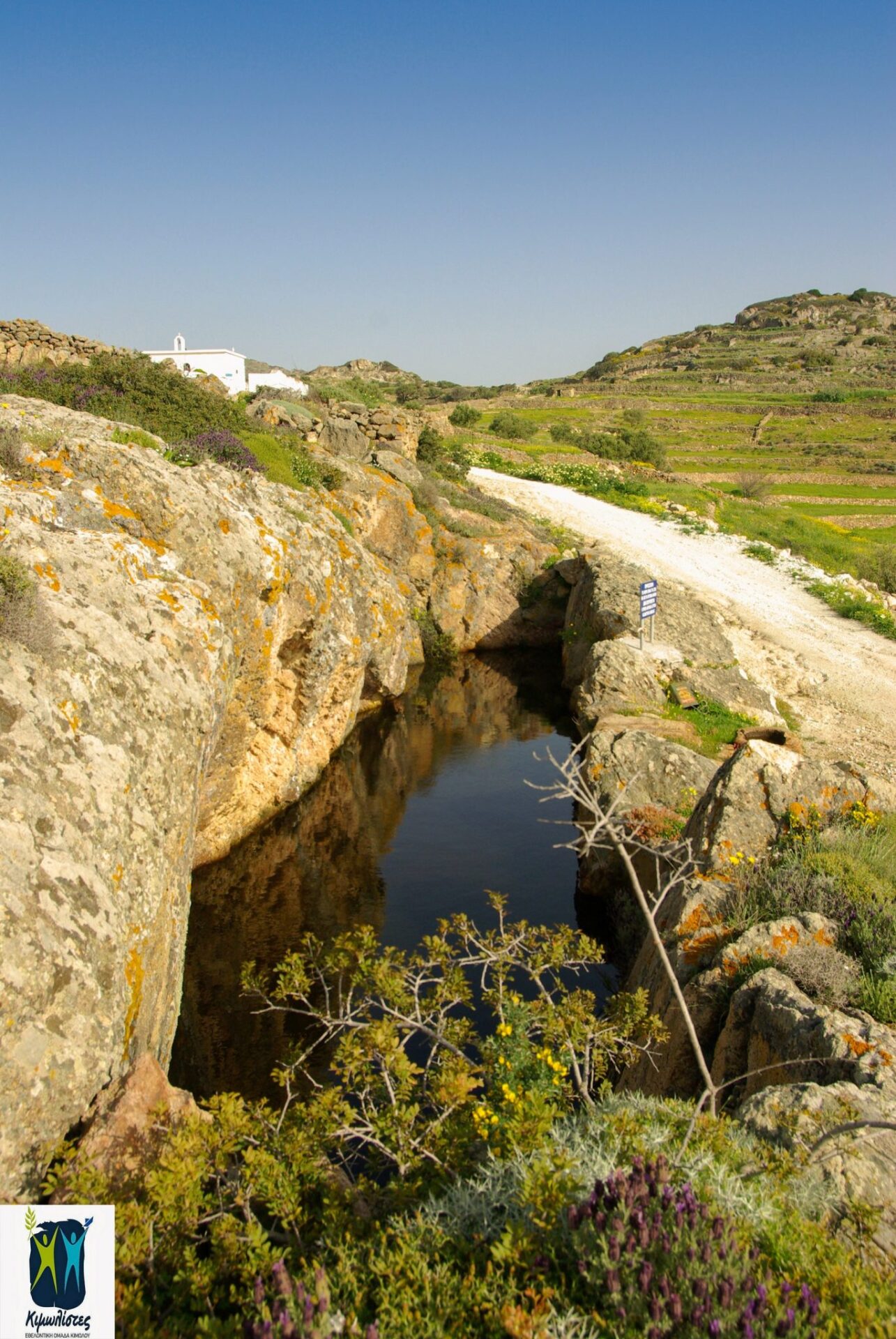
The route starts from the Chorio, from the Ipapanti church. Turn left just before Agios Eustathios church and following a concrete road and the “Skiadi” sign, you arrive at the position of Lebounia, where there is a bridge in the stream and eucalyptus (approx. 750 meters). From there, you either turn left onto a dirt road or you continue in the stream straight and you come across a path, without a sign, which will then take you back to the dirt road at a point where there is a large “ampourdektis” (stone lake with water).


Keep going through the Agioi Anargiroi chapel. After a little dirt road left to the Prophet Ilias, after about 3,500. count from the beginning, you will reach the Sklavos site.


 Going up the road to the intersection, turn left.
That’s where you go down a path and then an old Kalderimi.


Just below two stone old farmhouses on the left of the old Kalderimi, (800m. about from the beginning in “Sklavos,”) you will meet on your right a crossing for the path to Paliokastro, which you follow in the direction of NW.


After 450m. you’re reaching a crossing and a stone agricultural house where you’re going to follow the right section labeled number 3 in a northern direction, moving between old stone structures that give the path a non-distinctive graphicality in the Kefales area.


The path passes to the left of the tallest peak called “Paliokastro” and there are ruins of the ancient castle and the so-called “Konsolinas Cave” that you can reach from a signposted path to the right by choosing:(a) a steeper one that turns right to about 20 meters and passes through the “Portara” and requires caution or (b) following an easier path which initially moves straight in the same direction and then turns right rising towards the “Consolina Cave” and the top.


Returning to the main path, after passing by a natural through, you start to take a downhill by following the right path marked at the last intersection. Move from the beginning of the path between olive groves, terraces and “xerolithies” (small walls of stones). You gradually downhill with the Aegean on your left and striking rock formations on your right. Continuing downhill, you’re in a well-preserved threshing floor and just a little downwards you will find a house carved in a smooth rock.


From there, you carefully follow the right downward point of the trail, east of the rock and behind it, you pass through an abandoned vine, continuing down the path with the same mark between terraces with olive groves, you get very close to a small peek where the access to the Castro beach is located. 40m beyond its left edge there’s a little V-shaped beach called “Fidaki”, where hot water flows to the sea. If you don’t go towards the coast but continue uphill and then evenly north, after 15 minutes you’ll find yourself on the second beach in the area called “Agioklima”.


Alternative: There is the availability of a circular route, if you continue from the beach “Agioklima” on path number 5 by following the good marking and climbing NE between the terraces and the olive groves, after leaving the ruins to your right and left side, to find the old Kalderimi, reaching the col in the “Gabas” location where there are smooth impressive rocks. Continuing on the rock-cut path towards the south east and south later, you reach the chapel of Panagia Himeli and from a well preserved Kalderimi end down to the dirt road that will take you to Chorio from another route.
Label number: 3, Overall length of path: 8.5km


 invites you at the Medieval Castle of Kimolos on Thursday 7/10/2021, closing with two screenings the successful course of Cine kalisperitis for this summer!")
