

CHORIO – CHIMELI – GAMPAS – AGIOKLIMA BEACH – FIDAKI
Placement on the map and altimeter presentation of the path.
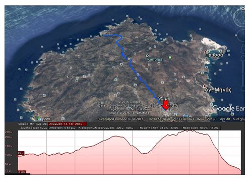
Path length: about 6.8 kilometers
Walking hours: about 3
Difficulty level: medium
Beginning altitude: 95 meters
Maximum altitude: about 240 meters
End altitude: 0 meters
DESCRIPTION
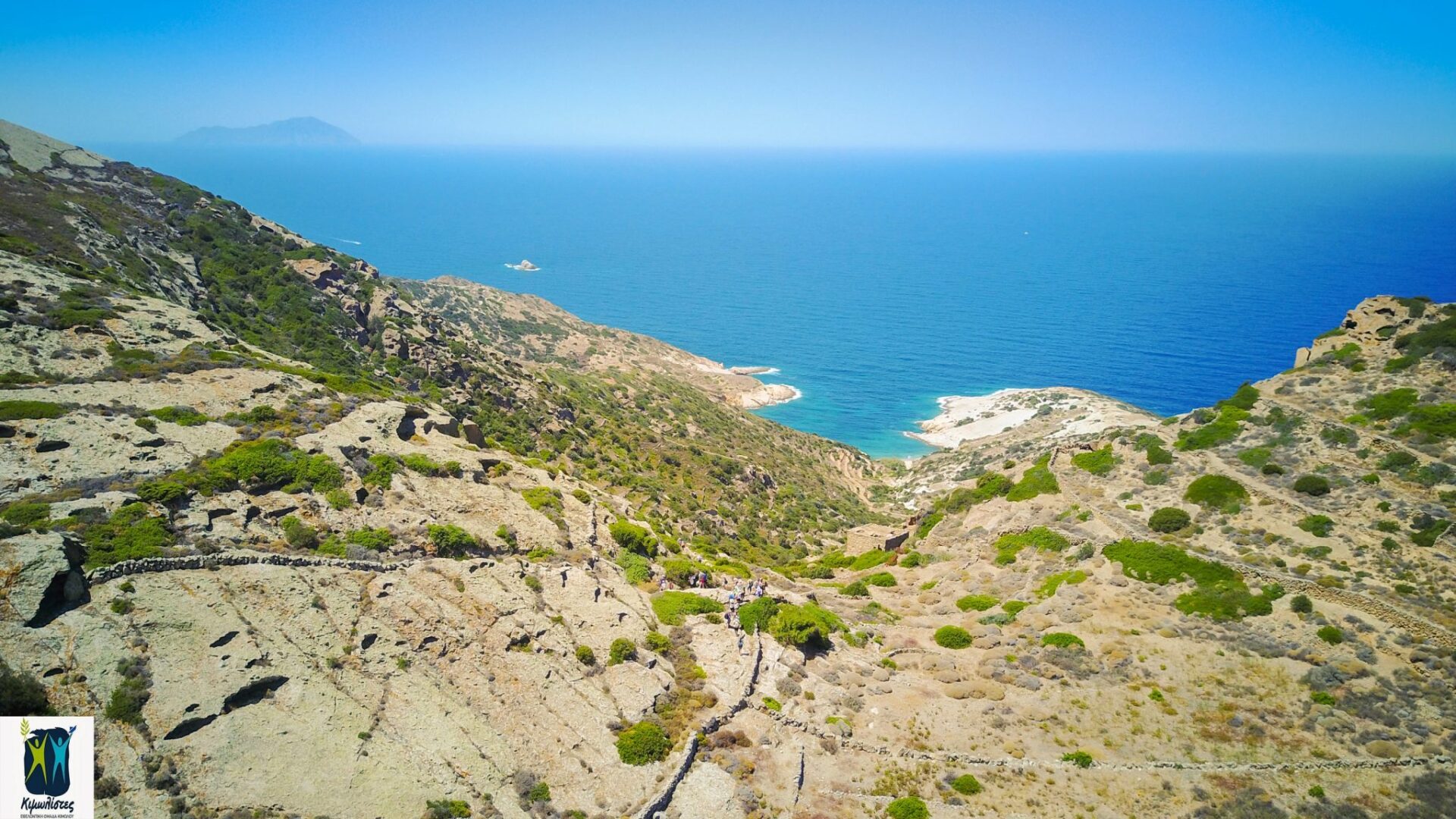
The route starts from Chorio, turns next to and left of the Agios Efstathios chapel, followed by the very well preserved Kalderimi that flows from arable olive groves to terraces and beautiful Xerolithies (small walls made of stones).


Down to the right you see in another Kalderimi the island’s only old stone bridge and the eastern crossing of paths and roads on the island. Continuing on to the Xevri’s site you see around the scattered chapels of the Kimolian Countryside and the view of the geological relief of the almost round island. Going up, you’ll reach a dirt road that upon following it, you’ll find yourself on a dirt road crossing.


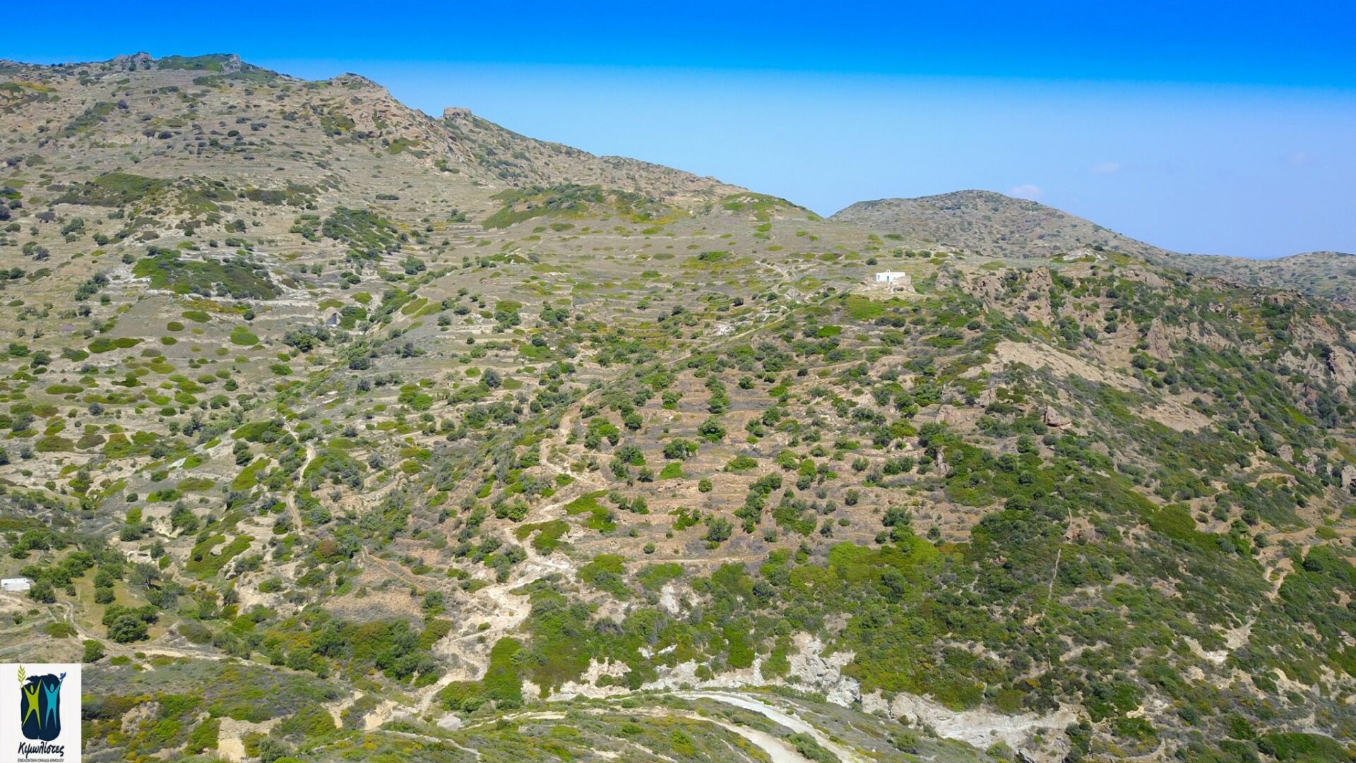
From there you have the option to either follow after passing the intersection of a downhill Kalderimi to the left reaching the dirt road where the concrete underground drinking water tank is located or follow the downhill dirt road until you reach the above-mentioned tank well. From this point onwards an uphill well-preserved Kalderimi is started with the label number 5. Going up it passes under the chapel of Panagia Himeli and continues to reach the col overlooking the northern coast and the Chorio.

 After the col, the well-preserved path continues for about 20′ almost evenly and reaches a smooth extensive rock (Axladies area) with an infinite view across the northern side of the island. Following the almost carved path (The red mark on the left leads to the Palaiokastro, we continue straight) on the rock in the “Gampas” position, continue in the col leaving the ruins of farmlands on your left you and start walk downwards by turning left and downhill in a western direction.
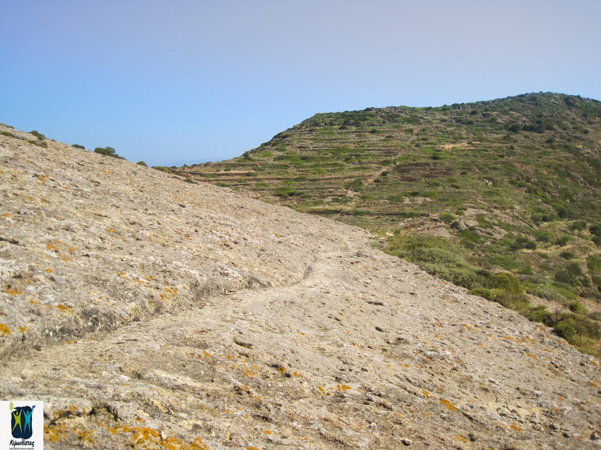
Axladies region. The red mark on the left leads to Palaiokastro, continue straight.


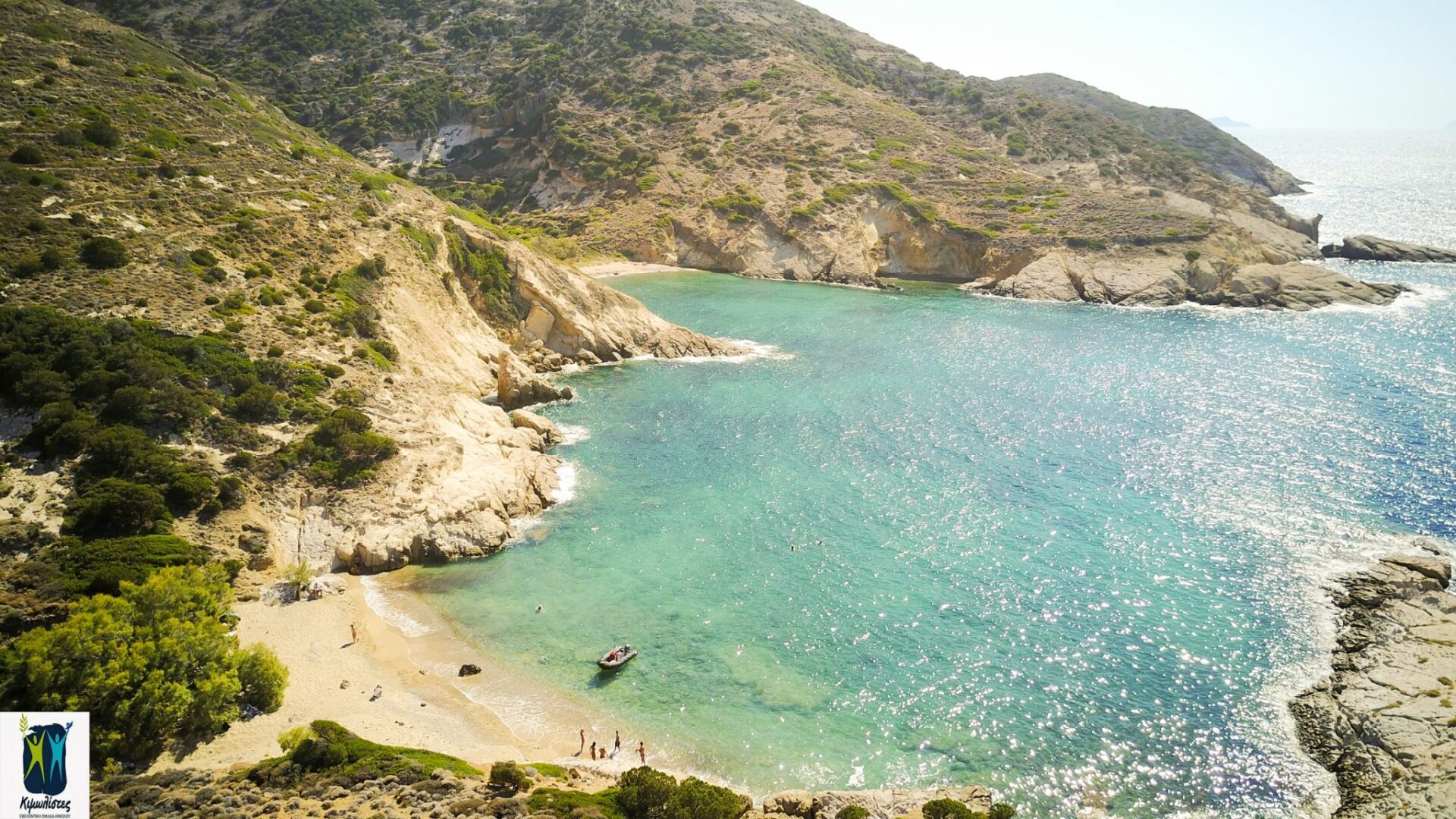
 The downhill path passes through ruins of farmlands and through olive groves and pins ends up on the beach of Agioklima. By swimming you can reach the little Fidaki beach, where very hot water flows from a spring into the sea.


 invites you at the Medieval Castle of Kimolos on Thursday 7/10/2021, closing with two screenings the successful course of Cine kalisperitis for this summer!")
