

CHORIO – SKLAVOS – SKIADI – BEACH MAVROSPILIA
Α. Placement of the route in the map

Β. Altimeter presentation of the route

Path length: about 7.6 km
Walking hours: about 3
Degree of difficulty: easy (attention needed on 2 downwards, after the Skiadi and Mavrospilia)
Beginning altitude: about 90 m.
Maximum altitude:: about 260 m
End altitude: 0 m.
DESCRIPTION
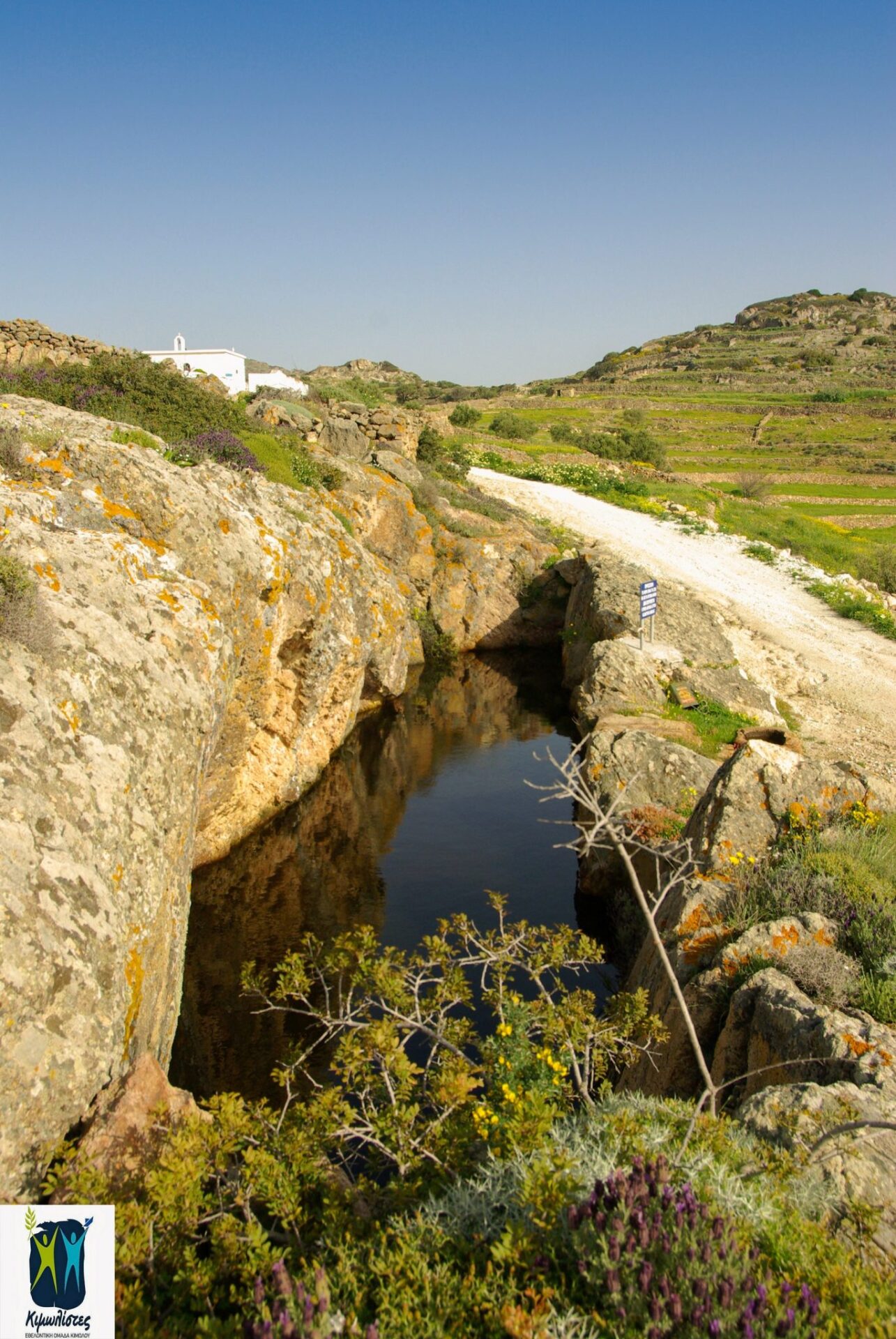
The route starts from the Chorio, from Ipapanti church. Turn left just before Agios Eustathios church and following the concrete road and the “To Skiadi” sign, you arrive at the position of Lebounia, where there is a cascade and eucalyptus (approx. 750 meters). From there, you either turn left onto a dirt road or you continue in the stream straight and you encounter a path, without a sign, which will then take you back to the dirt road at a point where there’s a big “ampourdektis” (lake in stone with water).


Keep going through the Agioi Anargiroi chapel. After a little dirt road left to the Prophet Ilias, after about 3,500 m. count from the beginning, you will reach the Sklavos site.


There you enter a path and then an old cobbled path which moves between olive groves, orchards and picturesque dry stones.


Just below two stone-built old farmhouses on the left of the old cobbled path, (about 800m. From the beginning in “Sklavos”, you will find a right fork on the path to Paliokastro. You continue straight on, ignoring the next right fork leading to Makropounta.

Branching (straight for Skiadi – Mavrospilia and right to Paliokastro – Agioklima).When you reach a farmhouse, the landscape changes and you are now hiking in special geological rocks, without vegetation. You see in front of you the “Skiadi” a monolith, a stone mushroom, a rare geological formation.


You follow the markings and you take the slope, in a wild landscape, you get to the bed of a marble, you go across upwards, and then you turn left, until you find the old Kalderimi again. Now, almost evenly, looking at the northern coast of Milos, you move by following the signs, you leave an old latch to your right, and gradually in the surrounding landscape you see olive groves again. In a while, down below, you see first the little but very beautiful Lakos beach that to reach you will follow a shortcut through cultivated lands. Following the path downhill, you reach the riverbed of a torrent on which you, moving left, are lead to the seasonal waterfall “Agriogato”, and by following to the right you arrive at the westernmost point of the Mavrospilia beach.


2a. MAVROSPILIA – DECAS – KALAMITSI – BONATSA – ALIKI
Α. Placement of a path on the map

Β. Altitude Path presentation

Path length: approximately 4.9 km
Walking hours: about 1:30
Degree of difficulty: easy
Beginning altitude: 0 m.
Maximum altitude: about 50 m.
End altitude: 0 m
DESCRIPTION
The return to the Chorio from Mavrospilia can be done with a vehicle, or alternatively you can proceed by walking through a combination of mostly on dirt roads, visiting all the beaches on the southern side. You cross the Mavrospilia Beach and move along the dirt road until after about 250 meters you turn right to Ellinika beach. On the right side of the beach, walking towards the rocks, you meet ancient graves, since the ancient city is located in the area. Crossing the Ellinika beach about in the middle you turn left and march to the dirt road, with a farmhouse on your right. You’re in the Dekas area. You keep on going about 1.5km. and then get to the assphalt, turn right and after walking about 200 meters you’re taking a dirt road on the left that’s lying on Kalamitsi Beach. The dirt road continues by the coast passing through the beaches of Bonatsa and Aliki.

Mavrospilia – Ellinika – Dekas


Label number: 2, Overall length of path: 8km


 invites you at the Medieval Castle of Kimolos on Thursday 7/10/2021, closing with two screenings the successful course of Cine kalisperitis for this summer!")
